The open RTK global network
Precision & Quality
Centipede-RTK is the only open and free GNSS network with an automated regular strict signal and base positionning quality control. This ensure that you will always have the best location service at any time.
Reliability & Global Deployment
Centipede-RTK is the first RTK network to deploy a global server presence on all continents with the best possible level of redundancy and reliability thanks to the anycast technology.
Open-Source Innovation
Our software stack is 100% open-source. Centipede-RTK is the only free and open network with a NEAR endpoint feature which automatically serves you with the signal from the closest RTK base from your location.
Advancing GNSS RTK Technologies
Our non-profit organization is dedicated to advancing scientific innovation in GNSS RTK technologies, making them accessible and freely available worldwide for the benefit of the public.
Use Cases
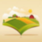
Precision Agriculture
Precision Agriculture is a modern farming technique that utilizes technology to enhance accuracy in planting, fertilization, and harvesting. By using sensors, GNSS RTK, and other advanced tools, farmers can optimize their crop yields while minimizing waste and environmental impact. With Precision Agriculture, farmers can achieve greater efficiency and profitability while contributing to a more sustainable future.
Surveying & Mapping
RTK offers precise positioning solutions for land surveys and construction projects. Our advanced technology and global network ensures high-accuracy results that meet your project needs. Check our coverage map in order to connect to the closest base near you.

Autonomous Vehicles & Drones
Autonomous vehicles have improved and will revolutionize the way we navigate our world. With precise navigation capabilities, drones, robots, and self-driving cars can now operate with greater accuracy and efficiency. This technology has the potential to transform industries and improve our daily lives in countless ways.

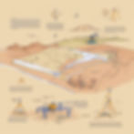
Geospatial Data Collection
Geospatial data collection is a crucial aspect of scientific research, especially in fields such as seismic studies, volcanic studies, and tectonics. One of the most effective methods for collecting accurate data is through the use of RTK technology. With its high precision and reliability, RTK can provide researchers with the data they need to make informed decisions and advance their studies.
Partners & Contributors
Centipede-RTK is supported and funded by trusted public and private partners. These partners are either specialized in infrastructure and computing resources, members of the GNSS RTK community, or scientific partners aiming to drive innovation and progress related to the use and widespread adoption of GNSS RTK technologies worldwide.

Testimonials
“I built my centipede base to use on a tractor for planting my potatoes, then I set up and advised the setup of several other bases in my area, all within the agricultural sector.
I will continue to advise on building new bases to expand the network and benefit from redundancy.”
Koulm S.,
Centipede-RTK user
“I have been using the Centipede network for three years for my robotic lawnmower as part of the Openmower project.
I am very happy with it, no issues to report.”
Bruno L.,
Openmower user / Maker
“The GIS service of SDIS34 captures 360° views of fire trails [...] We chose to use the centipede network [...]. The accuracy of these surveys allows us to consider new uses: calculation of slopes and camber of fire trails, precise positioning of fire hydrants, etc. Thank you centipede!”
Nicolas Moyroud
GIS Engineer - SDIS34